Wednesday, June 30, 2010

Hacklebernie, Hetchel Tooth, Huckleberries and Henry Strauch: Common Uniqueness


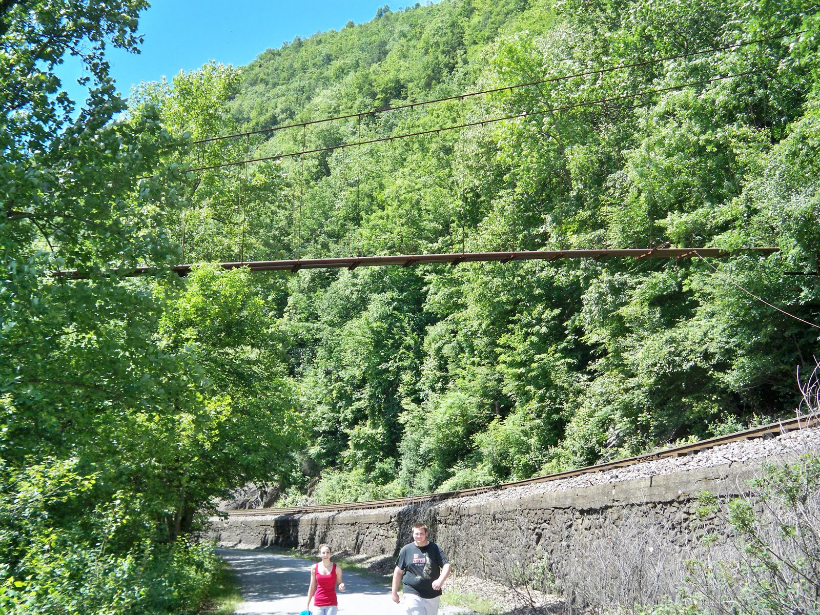
The view from Hetchel's Tooth through the Huckleberries.  That is East
Side Jim Thorpe, the Kettle, in the background.

The Strauch’s were commonly unique. My Great Grandfather Heinrich Strauch and his family were just common folks, but strikingly unique. Perhaps a sampling of Strauch anecdotes will explain what I mean.


The Strauchs first lived in Hacklebernie, in the western extreme of upper Mauch Chunk (Today's Jim Thorpe). Heinrich was a butcher and may have worked in the Mauch Chunk sausage factory, which at the time employed many men in that vicinity. Sometime around 1908, the Strauch family moved to Jamestown, near Lehighton.  (The picture below is the Hacklebernie school house around 1900.  I can imagine my grandmother Mary as one of those indistinct faces.  Above right, huckleberries looking off Hetchel Tooth.)


The 1910 Census described Heinrich as a “slaughterhouse butcher.” I can imagine him working at Joe Obert’s Meat Packing plant. The cattle were shipped to downtown Lehighton and herded across First Street.  Fancy that in today's world.

My grandmother Mariah or simply ‘Mary’ was the oldest, born in 1889. She and sister Catherine (‘Kate’ b. 1890) married in their early 20s. Carolina (‘Lena’, b. 1892) died young of ‘consumption’. She was said to have uncommon beauty and to be her father’s favorite. In the family photo, taken around 1915 to preserve her memory, she is positioned at her father’s right hand. With her clear determined eyes, she is truly stunning to see. Other sisters were Elizabeth (‘Lizzie’ b. 1895) and Anna Margaret (‘Margaret’ b. 1906).  (Back row: Henry, Leonard, Kate, Louie, Willie, Mary and Edwin.  Front: Lena, Heinrich, Margaret and Carl, Anna Margaret and Lizzie.  Opposite photo: Willie in his WWI uniform.)

William (‘Willie’ b. 1893), Ludwig (‘Louis’ b. 1894), Leonard (b. 1899), Heinrich (‘Henry’ b. 1903), Edwin (b. 1904) and Carl (b. 1908) were the Strauch brothers. Willie, Louis and Leonard served in World War I. Leonard was in the navy and served in a lighthouse in New England.

Henry was too young for the first one, and an old-timer when drafted for the second. He served out the war in the Aleutian Islands. Edwin was said to be such the reader that he opted for the relative sedate job as Allentown library’s custodian, immersing his days in books. As far as I know, all the Strauchs had an uncommon love of books.

Aunt Margaret had a sophisticated air and classic Franco-angular cheeks. She was a longtime telephone operator and supervisor for Ma Bell. She would relay to us, with emotional freshness, the trauma the folks in eastern Pennsylvania and western New Jersey felt during Orson Welles’ ‘War of the Worlds’ program, sharing her memories of the frantic phone calls she fielded that night.

I’m told she had a few sensible suitors in her day, but I don’t think she ever appreciated or relished the idea of a man telling her what to do. Lizzie, the family matriarch, a Christian Scientist, never married either. Neither did Leonard. They shared a home together around 13th and Turner in Allentown. They chose not to own a car. In fact, the only Strauchs to ever own cars were Edwin and Carl.

This is one of my favorite Strauch distinctions: they were all great walkers. They walked everywhere. Uncle Carl was a self-proclaimed “Great Walker."  He claimed to "...take 10 and 15 and sometimes 20 mile hikes…fifty miles a week.” This, I’m sure, was said with much ado of natural proclivity and was certainly an allusion, a homage toward Thoreau and Emerson, for Uncle Carl was a man of letters, a scholar, a professor of note at Lehigh University.

Suffice for now, enough said: the Strauch’s were interestingly common, uncommonly unique.

Uncle Henry was my Dad’s favorite uncle. And of the Strauch Uncles, the one I remember best. He married late and delivered coal. During huckleberry season, his delivery truck would be parked at his sister’s, my grandmother’s home on Ninth Street Lehighton.
The Gorge from Hetchel's Tooth.

He’d walk up and over Flagstaff Mountain and pick all day. The mountain was scrubby due to over-timbering and a few forest fires, ideal for the low-growing huckleberries. Sometimes he’d come again a few weeks later to pick from the higher blueberry bushes. I remember the two, quart-sized lard cans he’d carry around his neck with butcher’s twine. This would keep both hands free for picking. I only wish that I had been more interested then, back in the 1970s, to ask him about the war, his great walks, and his adventures in the huckleberry scrubs.

Serendipitous prompts finally lead me to the huckleberry scrubs this past June. I carried two quarts of water plus my popcorn bucket from “Cirque du Soleil.” I looped it around my neck with a “U.S.A.” lanyard. If I picked enough, my empty Nalgene bottles, carabinered to my workpants, could serve as extra berry storage.

Huckleberries are small. They grow in the lowest of bushes. It takes a lot of picking and bending to accumulate much of any kind of stockpile. For a few years now, I’ve wanted to experience an extended berry pick of my own, to go out in the morning and arrive home in the evening with a haul of berries.

I found it takes patient persistence and some awareness. The berries can be few and spread out. They grow among the rocks and in the type of terrain suited for snakes. My awareness allowed me to see a brown rattlesnake rustle away from me. Thankfully it saw me and ran before I had time to be frightened.  (Right: My solitude and stillness even fooled this deer, who walked ever closer steps toward me before realizing I was not part of the forest.)

Certainly anxious frustration, perhaps disgust can easily settle upon one’s mood during a pick. I did find some of that. But surprisingly, I actually found some zen in the monk-like stillness and calm, there is an all encompassing quiet focus the pick requires of the picker.

After five hours, after the threatening black clouds finally made good on their promise, I descended from the Broad Mountain with just under a quart of berries. Exhausted and soaked from effort and rain, I found my car still unfinished at the tire shop. Mike Willingham, an old friend from an older generation waited there too. He lamented and I agreed: berry picking is a lost art. Or maybe it’s just a lost effort. Something surely seems lost in our current culture.

Odd effort sometimes has its own rewards. My Dad remembers going to the Lehighton AmVets with Uncle Henry. He remembered how he drank his beer with three fingers of whiskey. One story tells of his intemperance, how his wife nearly left him over it, and how his crisis sent him to his parent’s basement for several weeks, seeing no one. He put himself to the diligence of crafting wooden furniture, perhaps the bed I inherited from the Strauchs. He emerged without touching the drink again. Perhaps his berry picking grew out of his new alcohol-free persona.

By almost any definition of effort and outcome, huckleberry picking should be a lost art. I certainly could have mowed someone’s lawn or cleaned out my neighbor’s gutters in less time and effort. I could have been paid a conservative sum and still been able to buy more blueberries than I picked. Heck, I could have cleaned my own gutters and collected all the loose change from my sofa in less time, and had enough money to buy more berries than I picked.

But that would not have disconnected me from this hyper-connected, maximum-gratification, minimum-effort world of 2010. It would not have provided me the view from Hetchel Tooth. It would not have connected me to my long departed ancestor.

Something can be said for ‘great walks,’ for maximum effort for minimal reward, for stepping into an unknown place, in taking a chance, exploring uniqueness in quiet solitude.

And that is the best answer I can think of for my effort that day.

Maybe on some other day, I’ll do it again.

Monday, June 21, 2010

When I Close My Eyes - Belching Petroleum

I couldn't hold my tongue any longer...I just had to belch something...sorry...RJR

When I close my eyes I see

Brown water colors wicking onto white deckled paper
I can imagine it in green when I try.
But the brown is there each time I let my mind in natural pose
Each time I close my eyes.
It was always there.
I hadn’t noticed it until the crude started belching in the Gulf.
Belching and crudeness.
Belching Petroleum.
Some say we could see executives behind bars.
I laugh.
Tell Rush Limbaugh he’s right, it’s just natural, go ahead, eat at your oyster bar now, I dare you.
Thirst for the crude.
He loves belching with crudeness.
I enjoy seeing the color of my paints, as I mimic mother Earth
I will not be hurt when I close my eyes
Though in brown my spirit gets coated


Tonight I saw a golden sunset set, with a wash board white clouded sky.
The blue was blue, despite being June.
It was natural.
I can still see it when I close my eyes.


RJR – June 18, 2010

Sunday, June 20, 2010

Lehigh Gorge State Park Rail Trail Virtual Tour

Beautiful blues and greens of the Lehigh River
 just below Rockport and above Luke's Falls.

So you are thinking of biking or hiking the Lehigh Gorge from White Haven to Jim Thorpe (or vice versa)?  Well you've stopped at the right place.

The bottom of this post catalogs my bike travels from 2010 to the present.

Many people avail themselves to the various Pocono outfitters (as well as the Reading Blue Mountain tourist train service in Jim Thorpe) to shuttle them to either White Haven or Rockport to start their bike hike.

Most begin on the northern sections to arrive in Jim Thorpe to take advantage of the gentle two to three percent downhill grade.

From White Haven to Jim Thorpe, about 23 miles, the biker will descend about 600 feet of relief.  

(When I bike the entire trail from 2-miles up Route 940 in White Haven all the way to my home along Long Run Road in Lehighton, I travel exactly 30 miles.   Total trip down for me with minimal breaks and neither trying to break a personal best time nor doing much sightseeing, I usually arrive home in about 3 hours.  I usually average about 4.5 minute miles.  I enjoy taking a break at Penn Haven to stretch out my back.

For a return trip from home to pick up my vehicle the next day, I average about 5.5 to 6 minute miles and make it back in about 3.75 hours, which almost always includes a stop at Antonio's Pizza in the White Haven strip mall.)

When making your trip, be sure you have confidence that your bike make the entire trip.  Once on the trail, the only public access points are at White Haven, Lehigh Tannery, Rockport (about halfway), and Glen Onoko (Jim Thorpe).  I recommend carrying a portable bike pump and at least a tire patch or extra inner tube.  

The trail is monitored by State Park Rangers, but one cannot expect them to rescue stranded bikers.  Rockport and Glen Onoko access points are the only two spots along the trail with non-flush, public restrooms.

Rockport and Glen Onoko also offers river access for those inclined to kayak or fish.
The top of the trail in White Haven with its gentle descent
along 23-miles of trail to Glen Onoko in Jim Thorpe.  

Quick Overview of Major Stops and Sights to See: (from White Haven:)

  • Lehigh Tannery - This will be the only public road you will cross until you reach Jim Thorpe.  The leather tanning business was huge in Carbon's Industrial past.  The Lehigh Tannery has been mentioned as perhaps the largest tannery in the world.  Nearby Hickory Run State Park's history is tightly related to this industry as Hemlock tree (our state tree) was the prime bark used for its tannic acid used to "tan the hides."  There is a large lock (Lock #28) of the Upper Grand section of the canal here.  The Upper Grand senction of the Lehigh Canal differed from the Lower section from Jim Thorpe to Easton in that there was a system of about 30 locks and about 25 dams that dammed up the river to make slack water for the boats to navigate on the river.  The Lower Canal was a separate waterway along the river.
The waterfalls below Lehigh Tannery - June 2017 (Between mile marker 127 and 128.)

  • Water fall and park bench - An easy to walk to location from the Tannery for clearing you mind, a relaxing, quiet spot.

The Quartz crystal excavation site several hundred yards above Sandy Spring, near mile marker 125.

The ground is strewn with crystals shards.
  • Quartz Crystals near Hayes Creek - Around mile marker 125, look for quartz crystal debris along a dirt bank on the west side of the trail.  Venture up the bank and try your luck digging out crystals from the ground.  Some days after heavy rains can yield nice finds.
  • Crystals from Lehigh Gorge near Hayes Creek, mile 125.


  • Leslie Run is about 3.7 miles above Rockport.
  • Mud Run, scene one of our nation's worst railroad accidents with about 64 fatalities, occurred here in 1888 - (Click here for a story I wrote on this disaster.).  It's 2.3 miles about Rockport.
  •  Buttermilk Falls - Just above Rockport near mile marker 119.  
  • Rockport - This is a picturesque village in a tight ravine of the Buck Mountain Creek.  Explore the quaint village and also look for a tunnel where the Buck Mountain coal chute tracks went through.
  • Luke's Falls - Just below Rockport.  There is a round stone foundation of a water storage tank for refilling steam trains.  There is a lesser waterfall about a little below this near mile marker 118.
  • The river bank from the trail as Drake's Creek enters the river - June 2017. 
  • Drake's Creek -This is approximately 10.2 miles above Glen Onoko.  Mile marker 117 is between Drake's and Stony Creek.
    Rock overhang at Stony Creek -
    The bike and large RR timbers offer some perspective of the enormity of this cut out.

  • Stony Creek - This is 8.9 miles above Glen Onoko and 12.4 miles from White Haven. 
The bridge over Stony Creek as seen from the trail.


A cool pool from a mountain spring just below the
meadow below Old Penn Haven Junction - The icy
water soothing for tired feet.
  • Penn Haven - Mile marker 114 is between Stony and Penn Haven.  Penn Haven was a major juncture along the Lehigh Valley and Jersey Central Railroads that passed through here.  The LVRR maintained a small hotel in this remote outpost.  The original junction was about 1-mile south of the current crossover location.  You will now have live rail-tracks on your side of the Gorge for the remainder of the trip.  This area is the steepest and curviest section of the LVRR and subsequently many wrecks happened here.  Many of which I've chronicled on this blog (Click here for more.).  The area of Old Penn Haven, you will find the widest expanse in the entire Gorge, most likely attributed to 10,000 years or more of washout erosion from the confluence of Black Creek and the Lehigh.  Penn Haven once had incline planes that brought coal off the steep Buck Mountain on two sets of tracks.  There were also extensive coal wharves here on the river prior to the great 1862 flood.  The Upper Grand section of the Lehigh River were never again to be used after the breeches of the many dams contributed to the death and destruction.  The state legislature ended navigation of the river from that point onward.  Reds O'Donnell of Lehighton grew up there as his father was a "track watcher" living at the junction.  The steep sides of the mountains here were prove to rock slides.  At the top of the inclines you will find the remains of Dr. Druckenmiller's cabin, a local physician and avid sportsman.  (Click Here.) 


  • Bear Creek - Near mile marker 111, you are about 3 miles above Glen Onoko.
  • The Buckeye Pipeline - Built (between mile 110 and 109) by a union of independent oil producers in western Pennsylvania to combat the increasing monopoly grip that Rockefeller's Standard Oil.  It now carries fiber-optic cables.  The suspension-like bridge has an impressive anchor across the river built like a buttress of stonework, only visible when the foliage is down.
  • Hechtelstooth - There once was a village here too, but now long gone.  The last man known to live there died at an advanced age in the early 1960s.  Around mile marker 108.  Look high above at the bend in the ridge above you and see the sheared off rock.  The trail that takes you to the top of Glen Onoko Falls also can lead you to a trail cleared at the top of the Broad Mountain.  A 1-mile walk out this trail offers this striking view: 
A view from Hechetlstooth - Looking East - This is the bottom of the "Ox-Bow."
(Not a true Ox-Bow, but the course of the river from here up past Penn Haven is known as "The Ox-Bow.)
East side of Jim Thorpe is visible over the left side of the center mountain rise across the river.

  • Glen Onoko -This is the main access point for most visitors.  There is the old Jersey Central tunnel open to the public as well as river access.  Many also come to climb the Glen Onoko Falls.  However this should not be taken lightly, as the trail is quite steep and extremely slippery.  Many hikers have also been lured to the edge of the top of the falls for photos only to slip and fall on the extremely slippery rocks.  At least one hiker was seriously injured when someone above caused a small rock slide.  A much easier hike is to take the trail on either side of the Jersey Central Tunnel to sit on the rocks above the tunnel.  Though a bit safer than the Fall hike, this hike should only be taken if careful and mindful hiking is employed.  
The Jersey Central Tunnel overlooking the river.
The view out of frame to the right, across the
river was the site of the famous Hotel
Wahnetah that was burned by forest fire 100
years ago.


A Perfect Perch - The rocks above the Jersey Central tunnel offered this birdseye view of Reading and Blue Mountain's #425 Steam Engine through the Lehigh Gorge at Glen Onoko.  Hearing just one steam engine blare through the gorge makes it easy to comprehend the noisy confusion that led to the death of my grandfather Zach Rabenold's cousin Miss Jennie
Rex of the Mahoning Valley.  She and her friends made a Sunday afternoon trip to hike the falls in August 1901.  Upon just avoiding one oncoming steam engine on one set of tracks, Jennie froze when another train close in on her from a different direction on another set of tracks.  Her friends were able to move out of the way.  Her mutilated remains were sent home to the Lehighton depot in a burlap bag on a freight train.
(Click here for more on her story and other deaths along the Gorge from that time period.)


Click the following links for more historical information about what you will experience riding the Lehigh Gorge:~Carbon's Most Desolate Place & the life of Reds O'Donnell~Penn Haven Junction: the Epicenter of Sorrow and Railroad Deaths (1st of 3 parts)~Steep Grades and Dangerous Curves - Part 2 of 3 of the wrecks of the Lehigh Gorge
~"A Name of Terror for All Time" The Mud Run Train Disaster - Part 3 of the Series on this blog
~Penn Haven and the Upper Grand Canal link~Hetchel Tooth and Huckleberries along the Lehigh Gorge
~Video of Steam Engine #725 approaching Penn Haven on the Lehigh Gorge in August 2015
~Video from Lehigh Gorge excursion train from May 2011.


Below you will find various entries from me over the years, mostly of the flora and fauna of the Gorge:  I hope you find this post useful for your own travels.  Should you have any questions, do not hesitate to email me at: ronjon67@ptd.net

Enjoy!


Indigo Bunting - The Lehigh Gorge is one of the best places
to spot this fairly elusive bird.  The bird's striking blue hue is
due to the way light passes through the structure of its
feathers.  What you see as brilliant blue in sunshine will
turn to a dull gray-black if the bird dips into a shady cleft
of a rock.  I have often also observed Scarlet Tanagers
in the same moment that I see Buntings.
Tanagers are not averse to gathering in mixed flocks.  Many
birds employ this tactic especially when migrating for extra
sets of "eyes" as well as fly-catchers mix with berry eaters,
chickadees mix with kinglets as they sweep for foods
associated with each other but are not in competition for
the same food supply.  I've made several sightings of these 
between Bear Creek and Stony Creek each of the last 
ten years in June and July.


June 2016 Update: Some flora and fauna from the first 2 weeks of June 2016 of the Lehigh Gorge:
This adult wood turtle was as curious about me as I him.

Yellow phase rattle snake at the edge of the Penn Haven trestle of
the Black Creek.  Calm and well camouflaged, easy to miss.


This four-foot black rattler nearly got me.  As I was so intently scanning the
raised-track stone wall for reptile life, traveling at a fair pace, I nearly
ran this one over as he stretched across the Gorge trail, returning from the
river and sunning himself that cool morning, night-time temps were in the low 50s. 

Beautiful Mountain Laurel shrub just north of Penn Haven with this Eastern Tiger Swallowtail.

Besides Yellow-Swallow tails, there are also many
Black-Swallow tails as well.  Both varieties seem to
almost be curious of us humans and will often fly near
you and sometimes fly along with you for short stretches.
I do know the yellow variety seek out the salt in urine and
I've often found 20-30 circling and drinking from the
wet spots left on the ground of fellow trekkers in
the Gorge.  Of the Black variety, not the differences
between males and females.  Males will have a plainer look
to their pattern and a near solid line of yellow dots
across their lower edge of their wing whereas a female
will have more blue.


June 2011: Click here for my story about a day in the Black Creek Gorge, a tributary that enters the Lehigh Gorge at Penn Haven Junction ("The Day of Seven Black Racers..."). On Saturday, June 18th, I saw the Swallowtails "puddling" at Rockport and at Penn Haven Junction.  About 30-40 were kettling around one spot, some landing on it, most in flight.  They saw the males sense a mineral nutrient that is necessary for breeding purposes.  At Rockport, near the laurels to the right of the restrooms.  At Penn Haven, near the cement foundation on the spur that leads to Weatherly.  (Check the link above for more.)

A male Five-lined Skink takes a break from his frantic
sprints along the wall along the Lehigh Gorge.  As
naturalist Judy Wink once said, "Don't blink if you see a
Skink."  This lizard is quite the quick one.  Click this link for
 a YouTube video I shot.  You can see him panting, though
my presence stopped his fervent searching.
May 2011: Below are some new pictures a recent trip, May 21, 2011:


The Eastern Cottonwoods with their fluffy
white cottony catkins (more properly named
raceme) were quite evident all along the Gorge
this weekend, though many were pummeled
into the dirt by the heavy rains of the past week.


June 2010:

The following post chronicles a bike ride from Franklin Township, outside Lehighton, on up to White Haven along the Delaware & Lehigh Corridor and Lehigh Gorge State Park in June 2010.  Please return to this post from time to time as new pictures will be added from subsequent trips.  And if you ever have any questions about the Gorge for a trip of your own, feel free to contact me through this site or Facebook...Enjoy!

 I access the park from my home in Lehighton onto Lock #7 of the Lehigh Canal. (This picture is looking toward the Narrows section along the Lehigh Canal Lock #4, just below Jim Thorpe.)

From there, into downtown Jim Thorpe, cross the train tracks and back under the Jim Thorpe bridge that connects the downtown to the east side. It is here where the new trail head is located that will take you into Glen Onoko which is the southern extreme of the park. The northern extreme ends at White Haven, where my brother's cabin provides a resting point and solitude until my return home the next day. Total distance for me is 32 miles. From Glen Onoko to the next access point is 13 miles to Rockport. From there it is about 8 miles to the only intersecting road at Lehigh Tannery and another 1.1 miles from there to White Haven itself.
The following is this year's account of my trip, which instead of barrelling through to beat my personal best time, I stopped to investigate locks and the Penn Haven inclines. I will only be describing my journey north here, though some of the photos were taken on my return trip.

I hope you find this virtual tour useful in planning your own trip of the Gorge...Enjoy exploring...Ron


Just moments into my trek (...on my new Trek I purchased from Lehigh River Outfitters in Hazard Square in Jim Thorpe; I am quite pleased with my purchase.) four living creatures intersected: another human (wearing portable oxygen), a golden retriever, and a small fisher or a mink.  The retriever flushed it out of the canal bank as his owner grinned. It halted my progress as I bisected the line between the chaser and the chased.  We exchanged quick pleasantries and I continued, such welcomed diversions are common along this trail. 
After exiting the canal, over then under the Jim Thorpe borough bridge, you can enter the newly inaugurated trailhead.  Here is an ideal spot to start.  You can park your car in the County Lot, near the Jersey Central Railroad Station in downtown Jim Thorpe ($5 for all day.)   Or you can drive over the bridge, and park inside the Glen Onoko State Park.  On the bike, you travel up a 2-mile stretch, you enter the Lehigh Gorge State Park, which lies beyond this old signaling station and steel trestle.

A view of the sheared rocks above
Hechtelstooth, about 1 mile above
Glen Onoko.
There are numerous diversions along the Gorge depending on your tastes.  It is difficult to explore all of them in one or even several visits.  Slow down and enjoy just one or two, get the rest when you can.  I'm a frequent visitor, and yet have only climbed the falls maybe six times in my life.  My sons took me exploring Hetchel's Tooth for the first time on Father's Day (Above: The panoramic shot is from atop Hetchel's Tooth; the pic above it, shows what it looks like from below on the gorge).  The tunnel in the picture below has been named "Hole in the Wall" by visitors.  It was abandoned by the railroad tunnel and now is fun to explore.  You shouldn't need a flashlight if you give your eyes some time to adjust as you enter.
Once past Glen Onoko, I'm ready to simply spin.  And on most previous trips, I'm all about breaking my previous time.  But not this time.  I did my best and stayed out of my own rat-race.  I found this to be a most enjoyable Lehigh Gorge sojourn, as I made some new discoveries and as usual, made new acquaintances along the way.


Just a mile out of the Glen, I bumped into Mr. and Mrs. Waits (a former military dentist) of Franklin Township with their daughter Mrs. Snyder and her three children.  Her oldest daughter, Emily Snyder, just finished first grade at Franklin Elementary School with Mrs. Nichole Hydro.  Her grandfather said, "Maybe you'll have this man for your teacher in fifth grade."  She coyly averted her eyes.  Today's talk must be about biking.  "How far do you intend to get?" I asked.  Penn Haven is a nice destination they said.  You can stick your toes into the cold Black Creek.  That's about a 12-mile round trip, that'll do.  (STORY UPDATE September 2014: Emily Snyder is indeed in my 5th grade class!  I embarrass her all the time about this picture!  June 2017 Update: This past school year I enjoyed having the middle Snyder sibling, Madeline in my classroom!!)

Next, under the old Buckeye Pipeline that carried petroleum across Pennsylvania here to the east coast refineries but now carries fiber-optic cable, I met two of my former students.  There's always that little pause of retrieving names.  They always smile after I break the silence.  Vicky Schiffert and William Douthart were 5th graders back in 1997.  It did my heart good to talk to them.  The four-foot Black-racer and the three foot Rat snake were not the scariest things they saw.  It was the three inch Yellow-ringed garter that Vicky almost stepped on that made nearly made her heart stop.  We exchanged snake stories including my first experience seeing a Hog-nosed last week, how he regarded me with his cobra-like puffed out neck.  I've also seen Five-lined Skinks in the Gorge, something a species biologists claim to be unique to the Lehigh Gorge.  I've only seen one, one time and it  was only about 5 inches long.  Someone told me they've seen them much bigger.  The best place to keep your eye out is along the stone retaining wall of the elevated rail bed.
There are a few places with easy access down to the river.  This sandy-bar is about 1/2 mile below Bear Creek.  You can find nice round stones and pieces of coal.  Coal-silt outlines most banks along the Lehigh.


The Lehigh Canal, that ran the coal from Jim Thorpe down to Easton, was the brainchild of Josiah White.  At first, he tried to conquer the river with bear-trap locks (See May 15th Post: "He was the hand that Rocked the Cradle of the Industrial Revolution" ).  Then built the lower section in 1829.  Later, with Edwin Douglas, they built the Upper Grand section from Jim Thorpe up to White Haven.  This section, used dams on the river and locks at the end to bypass the dam.  What you see above here are the remains of the lock channel of Lock #9.  The 29 locks helped to overcome the 600 feet of relief between White Haven and Jim Thorpe.  There was a disastrous flood in 1841 that was eclipsed in 1862.  The Pennsylvania legislature stopped the Lehigh Coal and Navigation company from rebuilding, because the breeched dams exacerbated the destruction.  John Leisening, superintendent of the LC & N, estimated that 200-300 people lost their lives in the flood and from the surges that occurred when the pools of logs floating on the river acted like battering rams on the dams.

 About 5.9 miles north of Glenn Onoko, you will arrive at Penn Haven Junction where the Black Creek enters the Lehigh.  The railway branching left goes to Weatherly.  Here, the active tracks of the Norfolk Southern (formerly Conrail, and before that, Asa Packer's Lehigh Valley Railroad.)  Immediately above you will find the remains of the inclined railway built by the Hazelton Railroad that was later taken over by the Lehigh Valley Railroad. 


Here we see the remains of retaining walls lining the plane to the top, about 450-feet high.  At the top were steam powered engine houses to bring the empty coal cars back to the top and back to Beaver Meadows and Hazleton.  The Hazleton Railroad operated from 1832-1852, when they were abosrbed into the Lehigh Valley Railroad.  In 1850, they ran the first incline from the top of Penn Haven.  Then in 1859 they added the second incline, the 4-track bed on the left.  The planes were abandoned after the 1862 flood.
Here on the picture above right, you can see the pipeline leading from Black Creek up to the top of the plane to the Engine House.  The picture below right shows the enormous wall of the 1851 engine house.  The 1859 engine house would be on the left about 100 feet away.


Now for what you're been waiting for: the view.  The valley to the right leads to Weatherly, the Lehigh River and trail is to the left looking south toward Jim Thorpe.  I did not question what I was doing, climbing this hill after 12-miles into my 32-mile ride.  But sometime later, around mile 22, my legs were questioning my 43-year-old mind, "Why did you do this to us?"  It was worth it. 


Here's what the inclines looked like around 1860.  For a much more in-depth look at Penn Haven Junction and the Planes, please click here for a April 18, 2014 post about them here on this blog.


Next along the trail, you'll find Stoney Creek.  Though not marked on the new trail markers, it's about 1.5 miles north of this rock outcropping.  When you see Stoney Creek on the right, notice the large, expansive rocky ledge that hangs out toward the trail.  On my return trip the following day, I surprised a mother and her spotted-fawn, just like in Bambi.  Mamma run right and up, while the fawn tried to out run me south.  Tried as I may, I could not get out in front to turn the fawn around.  Finally it stopped and I get ahead of it.  As I snapped this shot, I saw Mamma cautiously watching from up the trail.


Next stop will be Rockport.  This is an almost mid-point rest area with non-flush lavatories.  The quaint, formerly bustling patch-town has some lovely architecture in a tight notch between hills that speaks to lore of its former glory. 

Luke's Falls, just before Rockport.

Here, the rafting outfitters have a river entry point where the Buck Moutain Creek flows into the river.


The water is amazingly clear with no moss growing in its bed, whether this is natural or a result of acidic mine draining I do not know.

Just above Rockport you will find Buttermilk Falls, a popular stop.  I've seen some people climb to the top, but have not done so myself.  I'm not sure if I ever will nor do I reccomend it.

Next up is Mud Run, site of the tragic passenger train collision in October of 1888.  Many trains were returning home from a Catholic Temperance parade in Hazleton.  Trains were set to leave at 10-minute intervals.  Well, the best laid plans of mice and men...Over 80 people were killed, wooden trains telescoped into one another, many mangled beyond recognition.  At the time, this was considered the worst train wreck in U.S. History. 
This is where I made the acquaintance of Adam Keller and Joe Kistler.  They were discussing the engineering of the 29 locks along the Upper Grand and how the Flood of 1862 ended river navigation.  Adam works for the Wildlands Conservancy and just completed work on the trail in the Lehigh Gap.  Joe, from Duncannon PA, where the Juniata River meets the Susquehanna, was once quite the avid biker, owning a Gary Fisher bike in the 1990s.  Now, at 71, a nice leisurely trek from White Haven to Rockport is more his style.  Tell me today that I'll still be biking at 61 and I'll be satisfied.  It was certainly nice talking to these gentlemen.

Mud Run is home to Lock #22 and it is a beauty and worth the stop.  This is a view from inside the down-river end of the lock.  I suspect this archway may be the water drain baffle for lowering boats within the lock.  This is definately on my checklist of places to investigate this winter.
Down here at River level, the Mud Run Creek enters beneath the New Jersey Central trestle arch.  A few years back a work-train crane tipped over here.  The operator jumped from it before it ended up in the river. (I know a forklift operator I grew up with who tried to do the same and was pinned in the chest by the roll cage, killing him.)  The problem though was the diesel fuel spill that was entering the river.  I remember seeing Bob Ford of the Times News walking up the trail, his large lenses in tow and a flushed, sweated face, arriving here by foot from Rockport.  I really appreciate the lengths our journalists go to to keep us informed, and more importantly, keeping us safe with their vigilance.  I thank you Bob!
Above left, the Mud Run ravine and bridge from this Jersery Central ariel photo from the 1950s.  Below left, a closeup of the merging waterways.
The mile markers come at more and more quickly at the end.  I'm entering my 5th hour of the ride, doing a considerable amount of exploring.  With minimal breaks, this trip from Lehighton, through Jim Thorpe, to White Haven, is normally around 3-4 hours for me.  (In the photo to the left, Adam Keller of the Wildlands Conservancy and Joe Kistler whom I met at Lock #22.)


Being so close and riding so long, my thoughts turn to food.  And that can mean one thing: Antonio's in White Haven, home to Piero and Dan, home of one of the best Stromboli's you'll find.  In fact, Kurt Busch and Greg Biffle and their crews always stop here for a meal when in town for the June and August NASCAR races.  (Here's Danny at the counter taking the dough and Piero behind working it...Thanks guys, you're the best...)
This was Thursday afternoon, June 17, at my brother's cabin.  It was chilly.  A nice afternoon, disconnecting from daily life.  Disconnecting from a hyper-connected world.  A nice day and evening.  The next morning's breakfast at the White Haven Diner was just what I needed for my ride home.  A short stack of pancakes for carbs and "death-meat" scrapple (as my wife likes to call it) for protein?  I had a lunch date with friend and fellow historian Bill Allison at Mollies at Noon sharp.  I did a few forays to lock #28 and #22, and of course the interactions with Mamma and Baby deer, and I arrived into Jim Thorpe at 11:50, just as Bill was crossing the street.  A Ceaser salad at Mollies Pub hit the spot.  And like the cold Romaine, this trip hit the spot.

AFTERWORD:
The following week, I did the gorge run again, as my brother Randall Rabenold was visiting from Charlotte NC (CLICK HERE to see his corporation of specialized investigations and brand protection Vaudra LTD.).  This time, a straight run without any investigations and made it in 3 hours flat.  It was a major Francis Walter Dam relaease weekend and kayakers, rafters and just palin old "tubers" were everywhere.  We "tubed" in our old truck tire tubes from below the dam to just before White Haven.  It normally would take us about two hours and made it in just over one!  It was a good run.  We saw two of mamma mergansers, with their fledglings.  I was home in ten minutes under 3 hours with a few stops to investigate some snakes.  This first one I estimate to be about 3 1/2 feet, a Timber rattlesnake.  It was quite docile and lethargic, which made him an excellent photographic subject.  These were taken about 1/2 mile above the Buckeye Pipeline.


A Word About Snakes on the Gorge:
Yes there are snakes on the Gorge.  And during my 20+ years of riding through the Gorge I've never heard any stories of anyone getting bit.  Also, keep in mind when I'm riding, I am in constant look out for them, as I enjoy watching them.  Many people travel the Gorge nearly as much as I do and comment to me how they never see them.  Below here are a collection of shots I've taken over the years of rattle snakes, copperheads, and rat snakes.  I've also stumbled upon a few hog-nosed snakes over the years as well.  I don't feel a fear of snakes should keep you from enjoying the Gorge, but you do need some vigilance to avoid them at times.

The other snake was being handled by two local amateur snake handlers out for some Sunday field work.  This is the second rattler they discovered that day, though they tell me they missed the one I photgraphed above.  This one, in his black phase, was found at the base of Hetchel's Tooth.


August 6, 2010 - On a bike ride from home to the Gorge today, I saw two black rattlesnakes.  The first was near the entrance to the Tunnel at the Park Entrance.  It was about four feet long with ten visible rattle segments.  It slowly rattled as it cautiously crept across the dirt lot toward the rocky hill.  He then scaled up about 1.5 feet and coiled on a small ledge of rock.  When I returned an hour later, it was more tightly coiled and calm.  The second snake was about 1/2 mile before the Buckeye Pipeline in the grass on the Lehigh River side of the trail.  This one was stubborn.  I first tried to roll my bike toward it to get it to go down toward the river and out of the path of other bikers and to keep it away from the approaching state tractor with mower deck.  It took a few minutes to get it to move to the top of the embankment, only for it to come back to the edge of the trail again.  The second time it moved much quick and I didnt stop pushing it until it went over the embankment.  Minutes later the state tractor passed through.  I think it stayed safely on the other side.  It was about 3 feet long and had 6 rattles.  The first used its warning sound loud and long.  The second barely rattled at all. 


(Click here to see this copperhead, there are also water-snakes that look like copperheads too)


May 21, 2011 along the Gorge.